I lived for almost four years in Luxembourg and was very frustrated not to find a complete and reliable source with all the Roman archaeological sites of the Grand Duchy. To make it short, I just made this list for you: 30 Gallo-Roman sites of Luxembourg were described, located on the map and illustrated. :) If you are an expat living in Luxembourg or just an occasional visitor – I suggest you visit some of these places. You will discoveltor wonderful landscapes, enchanting forests and some spectacular stories from Luxembourg history !
All sites described in this post are also available with photos and descriptions in the TimeTravelRome mobile application. For your convenience, I provide in this post the GPS coordinates for each site to visit. If you wish, you can also find many pictures with places from this post in my Flickr album: Here is the link. Just scroll the list to find the right one.
But before we introduce each individual place, here is a short story about Luxembourg and its origins.
The Ancient Luxembourg
First traces of settlement on the territory of the city of Luxembourg go back to the Celts and are dated to the 2nd century BC. One hundred years later, around 50 BC, Julius Caesar troops occupied the Treveri lands, including the modern Luxembourg area. It is likely that local Celts chose to cooperate with Romans quite early: archaeological signs of violence are scarcer in the Luxembourg region compared to other territories conquered by Romans. Relatively peaceful relations with Romans were maintained until they withdrew in the early 400s. The province was abandoned in 406 AD following the invasion of German Franks.
During the Roman period of its history, Luxembourg was part of Gallia Belgica and was located at the intersection of two Roman roads: Augusta Treverorum leading from Trier to Reims via Arlon (called at the time Orolaunum), and the other one, that led from Metz (Divodurum) to Aachen (Aquisgranum). The site was fortified, and it was located close to Trier, which became in 293 AD the capital of the Roman Empire’ northern territories.
Roman Trier. By Kleon3 – Own work, CC BY-SA 4.0.
The modern name of Luxembourg presumably comes from “Lucilinburhuc”, which was the name of a small stronghold overhanging the valley of the River Alzette in early Middle Ages. The small fort located here was purchased in 963 AD by a Carolingian count Sigfrid from the St Maximin in Trier abbey. The etymology of the name is likely to be of Roman origin.
Visible remains in the city of the Luxembourg city are scarce at best, but many traces of the roman past are wonderfully preserved and displayed in the Luxembourg National History and Art Museum. The excellent exhibition includes many artefacts from all main Roman archaeology sites located near Luxembourg.
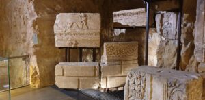
Blocks of a circular Mausoleum discovered in Luxembourg during the construction of the National Sports Institute in 1962. Now in the NHAM.
Roman Villa at Echternach
GPS: 49,8040531; 6,4119232
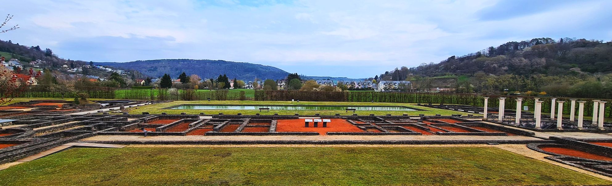
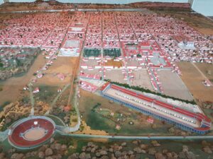
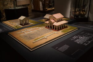
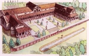
Echternach is famous for its Roman villa – one of the largest and most beautiful rural properties in the surrounding of the Roman Trier. This house was discovered in 1975, and after excavation, archaeologists discovered a genuine palace that contained 70 rooms with porches, courtyards, basins, mosaics and a system of underfloor heating. The impressive main façade was oriented to the northeast, and the rear façade to the warm southwest. The villa overlooked over a courtyard area of 500 x 210 m and had two Baths: one in the south wing and another suit of baths in north wing.
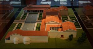
Echternach villa – reconstruction in the museum at the site.
The villa was first built in the middle of the 1st century AD on the site of a pre-Roman settlement, and it was significantly extended in the following century. The villa was destroyed around 275 AD, most likely because of the incursion of the German tribes, but it was rebuilt in the 4th century.
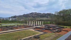
Echternach Villa – archaeological site.
Frankish nobility, including the Frankish ruler Pippin II, donated their inheritance to St. Willibrord for a monastery in Echternach. Parts of the Villa continued to be in use: the baths apparently became public while monks from the nearby Abbey used the remains of the villa as a quarry.
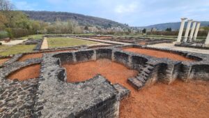
Echternach Villa – Baths area.
Visitors can see the manor house itself with some structures of its preserved or restored. In addition to ruins, there is a Roman garden, where some 70 medicinal and ornamental plants can be seen.
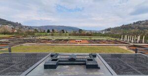
Echternach Villa – Archaeological site and the reconstruction .
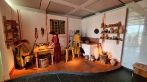
Echternach Villa museum. A scene from roman life.
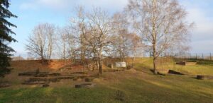
Ancient city of Ricciacum, Dalheim
GPS: 49,5382311; 6,2559389
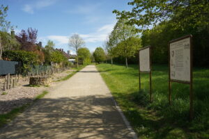
Situated to the south of the modern village of Dalheim in southern Luxembourg, there are the remains of the ancient Gallo-Roman settlement of Ricciacum. Founded during the late 1st century B.C. or early 1st century A.D. this settlement was once an important point along the Via Agrippa, the major Roman road connecting the Mediterranean world with the Rhine River. Such connections helped the settlement flourish, attracting trade and merchants.
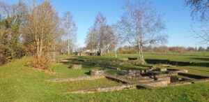
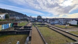
The archaeological site of Ricciacum.
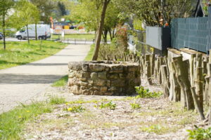
However, the site also suffered as a result of its location. Amidst the chaos of the second half of the 3rd century A.D., which included Germanic raids into the Empire, conflicts in the East, and the threat of imperial usurpers in Gaul and Britain, Ricciacum was sacked and destroyed in a raid in ca. 275 A.D. Similar events unfolded later in 353 A.D and again in 407 A.D. This last sack seemingly prompted a collective re-assessment by the residents, who elected to abandon the area completely in search of pastures new and safe. Ricciacum thereafter fell into disuse and disrepair. There are still impressive ancient remains at Ricciacum. Remains of public buildings including a temple structure and thermal baths.
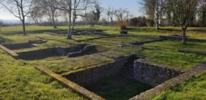
Remains of constructions at the archaeological site.
The most impressive structure to be seen at Ricciacum however is certainly the theatre which is in a very good state of preservation.
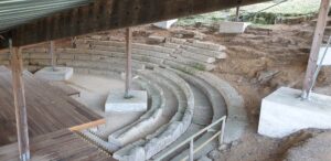
Remains of the ancient Theater at Dalheim.
Erected in the early 2nd century A.D. it is believed to have accommodated some 3,500 spectators. The theater was built into the rocky hillside – a previous quarry on the site made it an ideal location. An altar in the center of the orchestra suggests that the theatre had also a religious function. The theatre was abandoned at the end of the 3rd century. Some 360 stone seats from the upper rows of the Theater were later built into a nearby fortification.
Dalheim milestone (Verbrannte Bësch)
GPS: 49,560836; 6,253111
This another ancient Roman site near Dalheim – the Roman milestone in the Buchholz is one of the two milestones found in the vicinity of Dalheim. It was found in 1934 during road works on CR 153 near the parcel “Verbrannte Bësch” in Buchholz between Dalheim and Medingen. The original milestone is now in the Luxembourg National Museum of History and Art; it was replaced by a copy on the site.
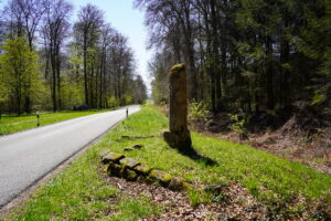
Millarium of Hadrian – Copy.
The milestone stood on the Via Agrippa that led from Metz to Trier – the Roman road runs exactly below the present CR 153 road. According to the inscription, it was built in 121 AD under the emperor Hadrian. It indicates the distance to Trier of 25 Roman miles, or appx. 37 kilometers.
Miliarium of Hadrian – the original in the MNHA.
Titelberg Hilltop – Capital of Treveri
GPS: 49,540278; 5,859722
The hillfort at Titelberg was constructed around 300 BC by the local Celtic tribe, many years before the arrival of the Romans. By the first century BC it was a prosperous urban trading center, defended by ramparts, and probably the capital of the Treveri tribe.
Titelberg – Capital of Treveri. Archaeological site.
Some twenty years after the Romans arrived in the area the Romanized settlement was rebuilt, with many buildings on the site being replaced by superior structures made of stone. Around twenty years later, however, these structures were abandoned and demolished in favour of Trier.
Titelberg – Capital of Treveri. Defensive moat surrounding the hilltop.
The ruins of this ancient settlement include the foundations of various buildings and of a Gallo-Roman temple. Archaeologists have also unearthed numerous evidence of metalworking on the site.
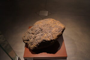
Iron ore was the source of Celts prosperity at Titelberg. This big block of iron ore from Titelberg is on display in the MNHA.
Finds from the site are preserved in the Musée d’Histoire et d’Art in Luxembourg.
Reconstruction of gallo-roman buildings at Titleberg I-II centuries AD. In MNHA.
Visitors can combine the trip to Titelberg with the visit of the nearby Fond-de-Gras ancient rains museum. The steam trains are still in working order and you can spend an unforgettable moment by taking one of these trains for a trip back in time.
Underground aqueduct at Walferdange – the Raschpëtzer Qanat
GPS: 49,666105; 6,148142
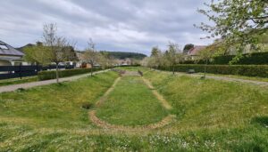
At Walferdange in Luxembourg there is one of the most interesting ancient sites of Luxembourg – the Raschpëtzer Qanat, an underground water system constructed by the Romans around AD 150. Thought to be the largest underground facility of this type built by the Romans north of the Alps, it comprised a six hundred-meter tunnel with connecting vertical shafts and supplied water to a large villa nearby. It remained in use for some one hundred and twenty years.
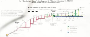
Raschpëtzer Qanat – explored sections of the underground aqueduct are painted in greed. Red areas remain uncovered.
As of now, some 330 m of the tunnel length of 600 m have been explored. Thirteen of the 20 to 25 shafts have been discovered. This underground system collected the water and led it to nearby Roman Villas in Helmsange.
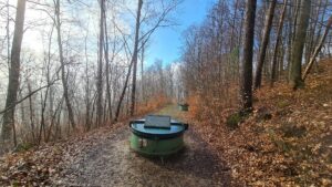
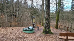
Raschpëtzer Qanat – wells in the beautiful forest of Walferdange.
The Raschpëtzer Qanat is located in a beautiful forest of Walferdange. The water is still flowing in the underground water flow.
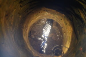
Raschpëtzer Qanat, well number 4. It is 12 meters deep, and one can still see the water flawing there.
Two wells are equipped with glasses and a lighting system allowing to observe ancient wells from inside and see the water flow.
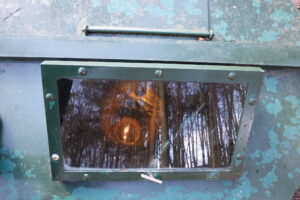
Raschpëtzer Qanat, Well number 4. It is 12 meters deep.
A deviation basin restored in 2000’s can also be seen along the path to the village of Helmsange.
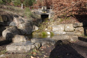
Raschpëtzer Qanat. Deviation Basin.
Raschpëtzer Qanat. The well number 5 is the deepest one – it is 35 meters deep.
Roman Villa at Helmsange
GPS: 49,6602; 6,140489
The archaeological site at the foot of the “Sonnebierg” in Helmsange was explored between the years of 1990 and 1994. The Villa was constructed at the end of the 1st century. It was 100 meters long and 50 meters large, which makes it one of the biggest in the area. It was an elegant construction with porticoes and a decorated façade. The Villa suffered from raids of Germanic tribes at the end of the 3rd century and was never rebuilt in its former splendor, but some of its rooms were still used at the beginning of the 4th century.
Helmsange Roman Villa.
Villa’s internal and outer walls were restored and reinforced so that the structure can be easily seen. Information boards provide detailed information about the Villa and its geographical context. The nearby underground gallo-roman aqueduct called Raschpëtzer Qanat represents another “must see” Roman place in the area.
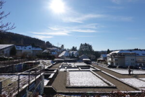
Helmsange villa under the snow.
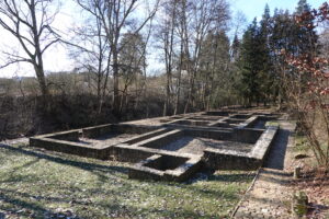
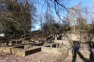
Roman villa at Goeblange (Miecher forest)
GPS: 49,677212; 5,9795422
The remains of the Gallo-Roman villa of Goeblange-Miecher are located in the small forest called Miecher, in the western region of Luxembourg, between the localities of Goeblange, Septfontaines and Nospelt. The site was discovered in 1964 by the priest Georges Kayser. An Association named after him continues to excavate and maintain the site.
Remains of teh Villa’ facade.
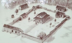
The agricultural estate was built during the 1st century AD and covers an area of five hectares. The main residence had an impressive façade with a veranda and projecting wings at either end, and was aligned towards an old funerary monument of the early 1st century. Because of attacks conducted by German tribes, the villa was fortified with three ditches, two banks and a timber palisade, but which were dismantled some three decades later. As the estate grew wealthier with time, one of the original buildings had been converted into a suite of baths about AD 200.
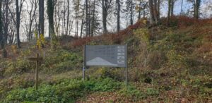
The archaeological site is very big: at least 6 buildings were excavated. They are not spectacular, but the extent of the site is impressive and numerous information boards provide a lot of information about the villa, archaeological findings, and the function of individual buildings.
Remains of a small ttemple near the main building of the Villa.
In addition to the Roman Villa, 500 meters to the north of the Roman Farm, several opulent Celtic Trevi aristocratic tombs were found. These tombs are well hidden in the middle of the forest, but they definitely deserve a visit too !
Celtic tomb.
Finds from the Celtic graves are preserved in the Luxembourg National Museum of History and Art (MNHA).
Information board at the site.
Gallo-Roman Baths at Mamer
GPS: 49,625046; 6,0377939
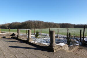
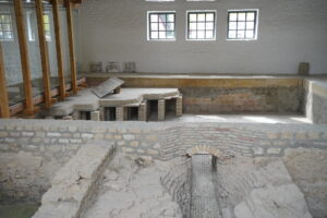
Mambra was a Roman vicus on the banks of the Mamer River and included a villa with thermal baths. At the east edge of the vicus there was a baths complex. Built about AD 70, it was originally a small structure measuring 14 x 6 m, but following additions and modifications the late 2nd and 3rd centuries it grew to be nearly four times as large. The Roman settlement was destroyed during Germanic invaders at the end of the 3rd century. The remains of the Roman Baths in Mamer were found on 1970’s. The structure can be visited freely – it is located inside of a small park.
Mamer Roman Baths – general view of the site.
The plan of the Baths is well visible thanks to reconstructed walls on the ground and the area is nice for a small walk or a summer lunch. However, there are no information boards on the site.
Roman Baths in Mamer – restored remains of the Baths structures.
Gallo-Roman necropolis at Diekirch
GPS: 49,869095; 6,161555
With a history that stretches to the Paleolithic era, Diekirch also once served as a vital Roman outpost within the footprint of modern Luxembourg. Established alongside a central Roman road that wove through the region, and archaeological evidence suggests that the settlement was rather vibrant.
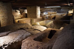
Necropolis under the St. Laurence church, accessible from the City Museum.
Some of the archaeological finds beneath the local church of St. Laurence can be accessed from the -1 floor of the City Museum. In particular, well preserver remains of the necropolis can be seen and visited freely, which is a very unusual and interesting experience. The city museum also hosts one of the 3 mosaics found there (two others are now in the museum in Luxembourg City) and few other remains from nearby archaeological sites.
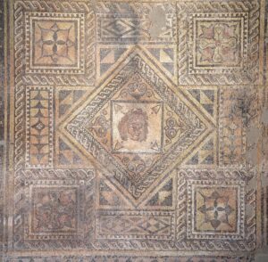
Mosaic in the Diekirch City Museum.
Gallo-Roman Temple at Steinsel
GPS: 49,6766269; 6,1132912
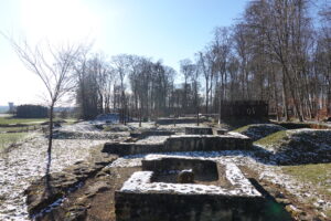
Located in the woods near Steinsel, there are the remains of a Roman-era sanctuary. It dates originally to the late first century AD, centrally located in an area with a number of expansive Roman estates. It remained prominent and in-use until the early 5th century.
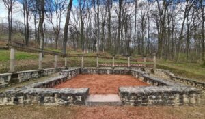
Steinsel Temple today.
Steinsel Gallo-Roman Temple, a reconstruction – from the information board at the site.
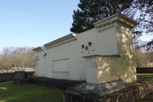
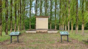
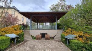
Roman funeral chamber at Bech-Kleinmacher
GPS: 49,5307; 6,35229
A small late roman funeral chamber was reconstructed on a hilltop overlooking the Moselle river. The chamber was completely rebuilt and surrounding vineyards provide very beautiful scenery. By the way, the wine industry in the region dates back to the roman times, which is reminded by a stone coming from a Roman wine press – it can be seen in the center of the village, near the church and next to the cemetery.
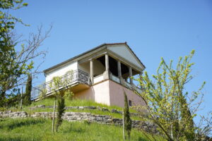
Bech-Kleinmacher Burial Chamber
Roman wine press at Bech-Kleinmacher
GPS: 49,531581; 6,353523
In 1985, in the vineyard “Naumberg”, and 2 meters underground, a 2,500 kilogram limestone block was found. The stone is a weight stone of a Roman grape press. The press is located under a contemporary protective structure in the small park next to the Church.
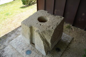
Roman wine press.
Roman Villa ‘Mies’ at Mersch
GPS: 49,746317; 6,0987592
The Roman Villa in Mersch was built in the 1st century AD. First discovered in the 19th century, the villa was excavated in 1965/66. It was one of the most splendid villas in the Trier region. The façade was 130 m long with a colonnade, while the building itself stretched back 60 m.
Mersch Roman Villa – Reconstruction. Main buildings of the villa are today beneath the residential area of Mersch.
In front of the Villa there was a large pool measuring 76 x 6.5 m and 2 m deep. The main building had two wings – in the west wing a heating seastem is still preserved. A funerary monument nearly 20 m fund nearby suggests that the owner of the villa was a former military officer, and that he later held an important civilian office in thne region of Trier. Only the basin (75 x 6.5 m) of the Villa can be seen in its entirety today the structures of the ancient villa being hidden underneath modern residential houses.
Mersch Roman Villa – Traces of the Villa’s pool.
A well preserved central heating system can also be seen, protected by a specially constructed building.
Mersch Roman Villa – Heating System.
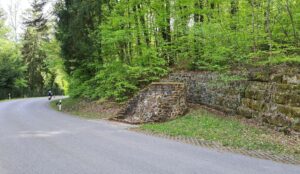
Gallo-Roman origins of the Vianden Castle
GPS: 49,935; 6,202778
The origin of the famous Vianden Castle is a Roman fort, dated 360-450 AD. It was likely used as a refuge during invasions of Germanic tribes. The main tower of the modern castle is located on the place of the ancient one. The ancient castle was rather insignificant, but it gave birth to the fortress which became, by the 11th century, the most powerful defensive system in Luxembourg. The castle gained in importance as Counts of Vianden played an important role under the rulers between the Rhine, Moselle and Meuse until the 15th century. Beautifully restored, the Vianden Castle is one of the touristic icons of Luxembourg and it definitely deserves a visit.
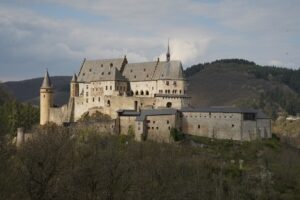
Vianden Castle – one of the top touristic attractions in Luxembourg.
There are no traces from the Roman past left on the site excepting traces of the roman ditch that can be seen in the Castle’ cellar (according to the movie that can be seen in the visitor’s center).
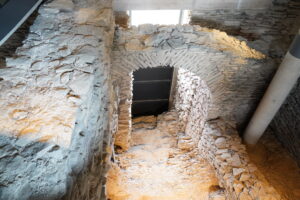
Remains of ancient and medieval structures of the Vianden Castle.
The digital 3D reconstruction in the visitors’ center is high quality ad it gives an excellent view on the early stage of the castle.
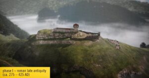
Vianden Castle in Roman times – a screen capture from the video reconstruction projected in situ.
Funerary monument at Grevenmacher (near Potaschberg)
GPS: 49,674293; 6,391913
Excavations were undertaken on the site in the 70’s – they allowed to discover remains of a wall and of the funerary monument, which once was 12 meters high. Some 1000 sculptural remains, including alone 58 heads, as well as numerous architectural fragments were found. The monument was built in the second quarter of the 2nd century, and it was dedicated to the owner of the nearby villa, glorifying his successes.
Grevenmacher funerary monument.
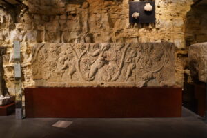
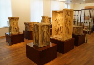
The tomb was richly sculpted and decorated, but only a few fragments were replaced in situ. Decorations on all sides had reliefs depicting scenes from mythology, everyday life, viticulture and wine consumption. The monument was destroyed in the late 3rd century, and reliefs were broken off and reused as stone blocks.
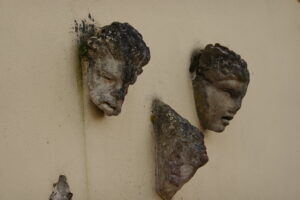
Decorative elements of the Monument. Originals are in the Luxembourg Arts nd History Museum.
Over a period of 250 years, 20 graves were placed in the walled funerary area, and burials continued until the end of the 4th century. The site was initially used as the necropolis of the Villa owner, but it was also used as cemetery after the end of the 3rd century, when the surrounding estates were destroyed by Germanic tribes. Some of the funerary urns can be seen in situ.
Remains of later tombs on the site.
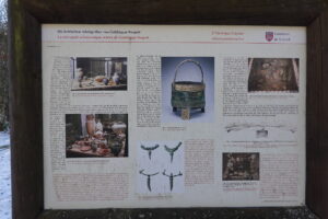
Gallo-Roman cemetery at Lellig
GPS: 49,725805; 6,46112
This is location Remains of a Gallo-Roman cemetery in the Weiler forest between Mertert and Lellig. Called locally Weiler Pfeilergrabmal, it was discovered in 1970. Archaeological finds can be dated to between 75 and 100 AD, and suggest that those buried here belonged to a rich family.
Lellig-Weiler funerary Monument.
The foundations on the site correspond to the remains of a funeral pillar, comparable to the famous column of Igel.
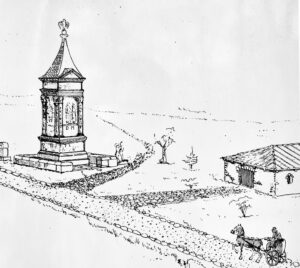
Reconstructed view of the Lellig funerary monument.
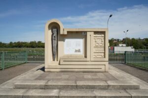
Funerary monument at Remerschen
GPS: 49,495483; 6,365628
The funerary monument at Remerschen belongs to a Roman “op Mecheren” Villa nearby. The tomb was halfway between the villa and the river. The tomb foundation of 8.60 x 5.35 was topped by a monument measuring 4.40 x 2 m. The front faced the Mosel river and showed portraits of the family with a funerary inscription. The rear part showed reliefs with scenes from everyday life. The remains of a grape-picking winemaker and a couple on a departing wagon have survived. On the sides were dancers, maenads from the entourage of the wine god Dionysus. The top of the monument consisted of a roof with a pine cone on top. The monument is located nearby the picturesque natural parc and can be accessed from a wooden walking path around the nearby lake.
The Remerschen Monument.
The height of the tomb has been reconstructed at 6 m. The original of the bas-relief representing Vitis (personification of the vine) flanked by Cupids harvesting the grapes is now in the National Museum of Arts and History of Luxembourg. Interestingly, during the Frankish period, the bas-relief was removed from the funerary monument, hollowed out and used as a sarcophagus.
The original of the Remerschen bas-relief in the NMAH.
Flaxweiler Tumulus
GPS: 49,655956; 6,353543
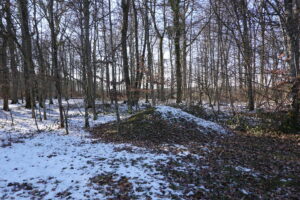
The Tumulus near Flaxweiler is locally called “Tonn” or “Tomm”, derived from the Latin tumba (= Grave). Covered with trees, it represents a prominent landmark. Excavations of the 19th century revealed an octagonal sandstone burial chamber. Unfortunately, finds were not preserved.
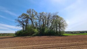
Flaxweiler Tumulus.
This Tumulus is the biggest of Luxembourg: it has a diameter of around 30 m and it is 7 m high. The burial place can be possibly dated to the 2nd or 3rd century AD and it is likely related to a wealthy family whose remains are located at some 700 m from the tumulus. The tumulus is accessible from the nearby road. It is very prominent and picturesque, but no parts of the ancient burial chamber can be seen.
Flaxweiler Tumulus.
Bill Tumulus in Finsterthal
GPS: 49,762397; 6,038397
When it was discovered in 1969, the burial mound had already been partly plundered and damaged. It had a diameter of 24 meters and originally was about six or seven meters high. The structure was excavated and dated to the third century AD. The tumulus was partly rebuilt with original materials. 18 meters of the circular wall and a part of the tomb were restored.
Finsterthal Bill Tumulus.
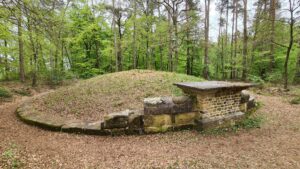
Altrier Tumulus
GPS: 49,745395; 6,326015
The tumulus near the village of Altrier was excavated in the 70s. A small wooden burial chamber was found with an Etruscan bronze vessel used as a cremation urn, a sword and, a fibula and a gold bracelet. The grave is much older than Roman burial monuments: the site was dated to the 5th century BC. The tumulus is located in a picturesque forest.
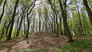
Altrier Tumulus.
There is a well detailed information stand providing insights about the grave. Finds are now displayed in the National Museum of History and Art of Luxembourg.
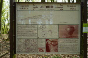
Information board at the site.
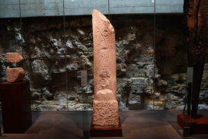
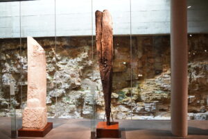
Gallo-Roman tomb at Altlinster (Häerdcheslee)
GPS: 49,728024; 6,21692
The place is called Härdcheslay: the word comes from the Germanic “lay” which means “rock” or “rock face” and “Härdchen” means “wooded hill” or “grove”. The main attraction is big sandstone with two figures depicted on its face. It is believed that figures, both 2 meters tall, represent a Gallo-Roman landowner and his wife, who lived in a property south of the Härdcheslay. The owner had a tomb carved for himself and his wife on the top of the rock that was part of an ancient Celtic cult site.
Häerdcheslee Roman Tomb Relief.
There is a rectangular hole on the top of the stone – the urns were placed here.
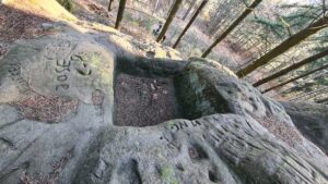
Häerdcheslee Roman Tomb Relief – Funeral Urn Chamber.
The stone is impressive by its prominent position and its size and depictions are unique in Luxembourg. The nearby Freylay group of stones is considered to be a Celtic cult place.
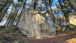
Ancient Celtic shrine at Freylay
GPS: 49,72852; 6,215868
Located nearby the Härdcheslay, Freylay is considered to be a Celtic cult place. Numerous marks and graffiti on sandstones confirm the presence of ancient visitors, although there are no ancient constructions on the site. The site is spectacular due to stone forms and many traces left on them by ancient inhabitants of the area.
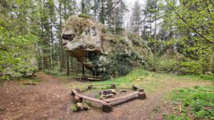
Ancient Celtic shrine at Freylay.
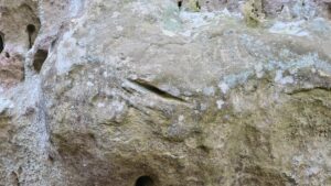
Ancient Celtic shrine at Freylay – Ancient marks on Sandstones.
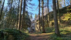
Ancient Celtic shrine at Freylay – Scenic “entrance” to the site.
Gallo-Roman Oven at Capellen
GPS: 49,64535339; 5,988645595
This well preserved Gallo-Roman oven from the 4th century was initially found in 2002-2003 in the Capellen-Hiereknapp parc, together with another oven and traces of storage facilities and residential building. The oven was later replaced to its current location for preservation purposes. The tiles and bricks factory was located along an important road between Reims and Trier, some 4 km from the Mamer vicus. It is possible that this factory was used for the vast reconstruction works conducted under Constantine after a period of Germanic invasions. However, new raids dated to the middle of the 4th century have stopped the production.
Gallo-Roman Oven in Capellen.
The site can be visited freely at the 68, route d’Arlon in Capellen. It is protected by a roof and can be observed from all sides.
Gallo-Roman Oven in Capellen – Protective structure over the Oven.
Gallo-Roman Lime Kiln at Senninggen
GPS: 49,644539; 6,235823
Discovered in 1938, this lime kiln was restored in the 1990s. It was in operations in the 1st century AD. As there are no lime deposits nearby, this location was likely chosen thanks to the Roman road between Reims and Trier that passed here. The construction represents a lime burner with a circular form. It was partly restored and is freely accessible from the road.
Senninggen Gallo-Roman Kiln.
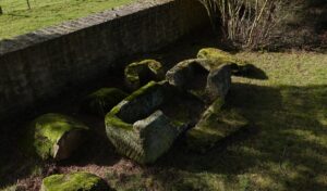
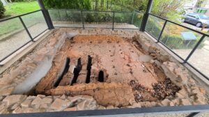
Ancient Bridge of Stadtbredimus
GPS: 49,567126; 6,363982
At this location, in 1962, the remains of an ancient passage of the Moselle were found. The Celtic origin of this passage dates from 140-122 BC. Later, in the middle of the 1st century Romans built a stone bridge – it stood on 5 stone pillars that rested on rafts of oak stilts. The bridge was part of the road from Metz to Trier.
Bridge monument with a copy of Bridge’ pillar.
In the local context, the bridge connected the settlement (Vici) of Ricciacum-Dalheim with Tabernae-Tawern on then other bank of the river. There are no authentic remains of the bridge at the site, only a modern monument dedicated to it. One authentic pillar from the bridge is preserved in the Luxembourg National Museum of History and Art (MNHA).
The authentic pillar from the bridge in the MNHA.
Vergötterstein in the Church of Berdorf
GPS: 49,821014; 6.349.143
Located within the St Jean church, the so-called Vergötterstein is re-used today as part of the altar. There are depictions of four roman gods on each of the stone, which originally served as the base of a roman Jupiter Column. Such columns are dated to the 2nd and 3rd centuries AD and they were widespread in Gallic provinces.
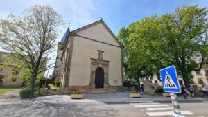
St Jean church of Berdorf.
The Jupiter Column of Berdorf originally stood in a Roman Villa located some 300 m south-west from the church. Four gods represented on the Berdorf stone are Minerva with a helmet, Hercules with a club and the skin of the Nemeian lion, Apollo with a lyre, and Juno with a scepter.
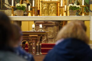
The Vergötterstein used as altar inside of the Church.
Roman buildings at Bonnevoie
GPS: 49,593072; 6,147351
During earthworks carried out in 1988 as part of the urban development, four buildings from the Roman period have been uncovered. Excavations made it possible to establish that remains were part of a Gallo-Roman farm built on the site around the middle of the 1st century AD. After partial destruction of the farm around AD 275/276, buildings were rebuilt in the 4th century. The site has been permanently abandoned during the 5th century. Only a few walls are still visible in situ, while the remains were recovered with ground for protection purposes.
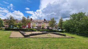
Roman wells at Bettembourg
GPS: 49,512376; 6,114393
During the development of the residential area An Leischemer in 1997 and 1998, remains of roman residential buildings were found. Some wells and cellars were relatively well preserved. One of them was the source of several archaeological finds – it was restored and preserved. It now stands in a little park along the walking path called Sonnenpromenade 2002.
The Sonnenpromenade 2002, information boards and a Gallo-Roman well.
The well is the only remain of the roman estate that is still visible. Some information boards are also present at the site. Note that the site is only 300 meters away from the Parc Merveilleux (a very popular amusement park in Luxembourg) – if you are visiting the Parc Merveilleux with kids, you may be willing to show them this gallo-roman site too.
Restored Gallo-Roman well.
Vichten Villa and its Mosaic
GPS: 49,80347; 5,995764
In 1995 a spectacular find was made in Vichten: it was a splendid and very well preserved Gallo-Roman mosaic covering 60 m2. The mosaic was manufactured around 240 AD in Trier and is believed to be one of the most beautiful Roman representations of the nine Muses.
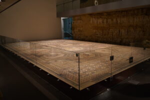
Vichten Roman mosaic in the Luxembourg National Museum of History and Art.
Vichten Roman mosaic.
First transferred to the Rheinisches Landesmuseum in Trier, the mosaic was restored and then sent back to Luxembourg. It is now preserved in Luxembourg National History and Art Museum located in the city center. A replica of the mosaic can still be seen in Vichten.
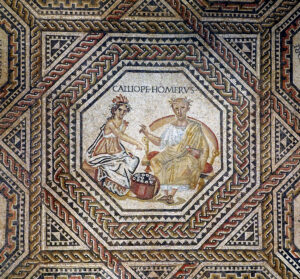
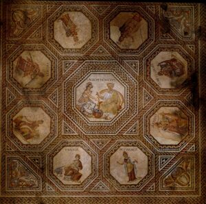
Vichten Roman Mosaic – Calliope and Homer
The Vichten Roman villa is located on private land and is the object of complicated exchanges between the land owners and the State. It cannot be visited. The only “Roman” attraction in Vichten is the copy of the mosaic.
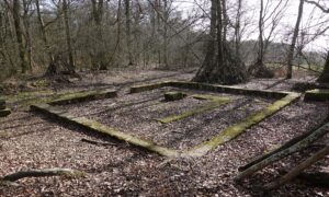
Roman Villa at Rippweiler (Bei der Laach)
GPS: 49,75725; 5,94291
The Roman Villa of Rippweiler is a portico villa situated in the forest near Rippweiler near the PC12 cycle path. The remains were discovered in 1971 and some excavation works were undertaken in the 2000’s. Remains of the villa that can be seen on the site are very scarce: the site can be visited but virtually nothing is visible above the ground. Some findings from the site are kept in the Vichten museum.
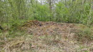
Rippweiler Bei der Laach Roman Villa – traces on the Site
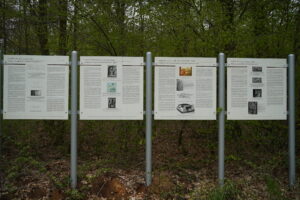
Rippweiler Bei der Laach Roman Villa – Information boards on the site.
Gallo-Roman Villa at Shieren
GPS: 49,824972; 6,101548
The Gallo-Roman villa of Schieren was first explored during the widening works of the B7 road in 2013-2018. Initial finds (including well preserved polychrome frescoes) confirmed its interest for archaeologists. The current excavations are focused on the main residential building of 4.000 m2. Besides this main construction, at least a dozen of auxiliary buildings were found. The surface occupied by the villa buildings and its court is 190 m to 415m.
The villa can’t be visited today as active archaeological excavations are being conducted on the site. According to press reports, this villa will become accessible for visits by 2023.
Luxembourg National History and Art Museum
The Luxembourg National History and Art Museum – NHAM is just very good: it integrates modernity, the quality of the objects and the pedagogy of the explanations. In addition to some of the objects shown below, the museum houses the famous Vichten mosaic and presents several originals of objects found in different parts of the Grand Duchy. Below are some highlights from its collections:
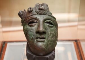
MNHA – Cavalry Helmet found in Hellange – Belsaker – I century AD. Produced in 30-40 AD, it is a visor of an army cavalry officer’ helmet. The iron helmet was not preserved, but the visor was cast in brass and it was found intact. Circular medallions on the helmet’ tiara possibly reproduce military decoration (phalera).
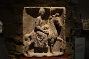
MNHA – Bas-relief of Epona, Medingen II century AD. Protective goddess of horses, ponies, donkeys, and mules, Epona rides a horse and holds on her knees a little dog.
MNHA – Jupiter Column element in sandstone II-III AD
MNHA – Finds from the Goeblange-Nospelt Celtic Graves
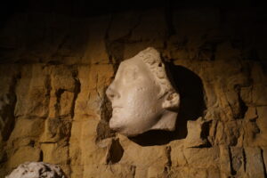
Head of Livia. Originally part of a bas-relief (from Rome ?), this monumental head of the Empress Livia was possibly brought to Luxembourg during Renaissance period. It was used as a decoration above the door of the Palace of Justice, former residence of the governor P.E. Mansfeld.
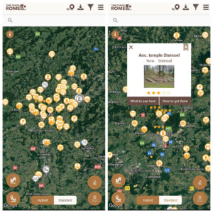
Luxembourg Roman Sites on TimeTravelRome app
The TimeTravelRome mobile application lists all the sites described above, as well as many sites that are located near Luxembourg in Belgium, France and Germany. Discover the most complete Guide to the Roman Luxembourg and hundreds of other ancient sites on TimeTravelRome !
Feature picture: Roman Villa of Echternach.
Source of all photos (if no other source is mentioned): TimeTravelRome.